

Serving Houston for Over 30 Years
A Long Trusted Leader in Houston Surveying.

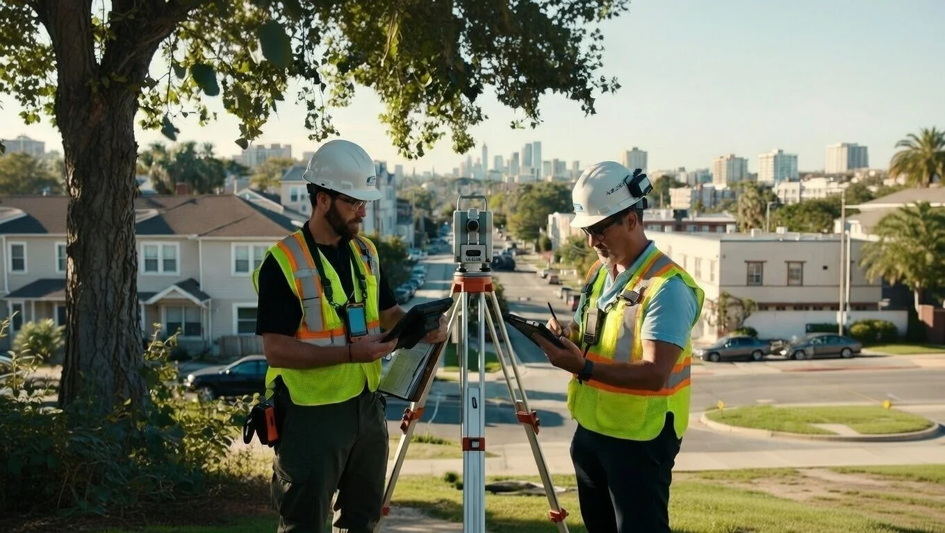
Boots on the Ground
Eyes in the Sky
At Bowden Surveying Partners, we combine decades of licensed Houston surveying expertise with today’s most advanced drone and LiDAR technology — delivering the perfect blend of proven reliability and ground breaking technology.
SERVICES

Conventional & Aerial Surveys
ALTA/NSPS Surveys
Boundary Surveys
Topographic Surveys
Construction Staking
Platting/Sub Division
Custom Mapping
Residential Builders and Developers
Commercial Construction and Engineering
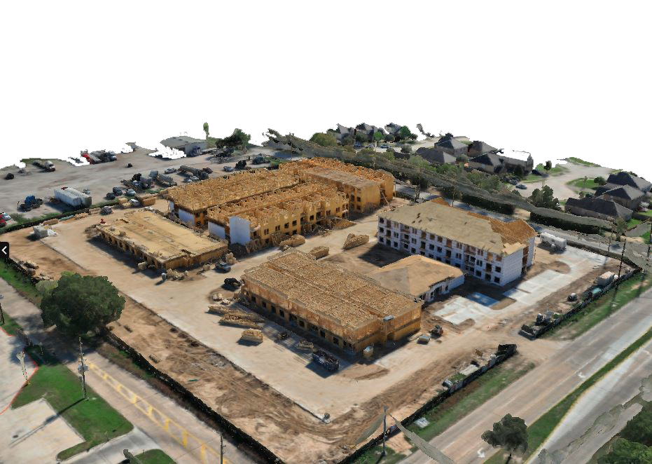
Reality Capture Surveys
We combine conventional GPS and robotic instrumentation with cutting-edge tools:
Aerial and Terrestrial Drones
LiDAR
Photogrammetry
All to create an easy way for architects, builders and developers to get 3D laser scans, BIM models and 2D survey plans
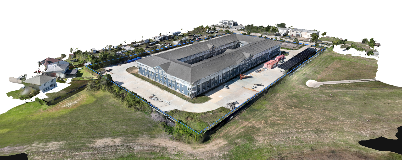
Visioneering
Get an Aerial or ground view of your project using High-Resolution 3D Modeling techniques developed by our Company to produce the most innovative and Realistic models available today.
Gaussian Splatting
Photogrammetry
Videogrammetry
Achieve Superior Field Intelligence Through 3D Scans
Millions of Laser Returns
that can penetrate vegetation, generating highly-detailed models
80% Reduction
In labor and field time
50% Lower Overall Project Cost
and more cost-effective overall
Now Utilizing
Visioneering
Bowden Surveying now utilizes Visioneering. By using a combination of the most advanced reality and geospatial capture methods. We are able to deliver highly detailed 2D & 3D survey modeling data that enhances accuracy, visualization, and project efficiency. These reports give all clients a deeper understanding of site conditions and support more informed planning and decision-making.
Common Uses
Site inspection, analysis, & planning
Earthwork & volume calculations
Construction coordination
Existing conditions & as-builts
Progress tracking over time
To learn more about Visioneering click below or watch the video.


Contact us
Hours
Monday–Friday
9am–5pm
Phone
(281) 531-1900
Address
Houston, TX